Academic Task 1 Map - 1st
Question
The two maps below show the coastal village of Port Mary in 2010 and today. Summarise the information by selecting and reporting the main features, and make comparisons where relevant. Write at least 150 words.
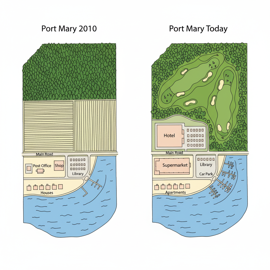
The two maps illustrate the significant transformations that the coastal village of Port Mary has undergone between 2010 and the present day.
Overall, the village has experienced substantial development, changing from a small, agricultural settlement into a larger, more residential area with modernised facilities. The most prominent changes are the addition of a large housing estate and the replacement of traditional local shops with hospitality venues.
In 2010, the northern part of the village was dominated by farmland. This agricultural land has since been completely redeveloped into a major residential area, featuring numerous new houses. To accommodate this expansion, a new network of roads has been constructed, and a park has also been introduced in this newly developed section.
Further changes can be observed in the village centre. The post office and the shop that were present in 2010 have been demolished. In their place, a new cafe and a restaurant have been built, indicating a shift towards leisure and tourism. While the church and the original houses have remained unchanged, the hotel situated next to the main road appears to have been expanded. The harbour to the south of the village has been left intact.